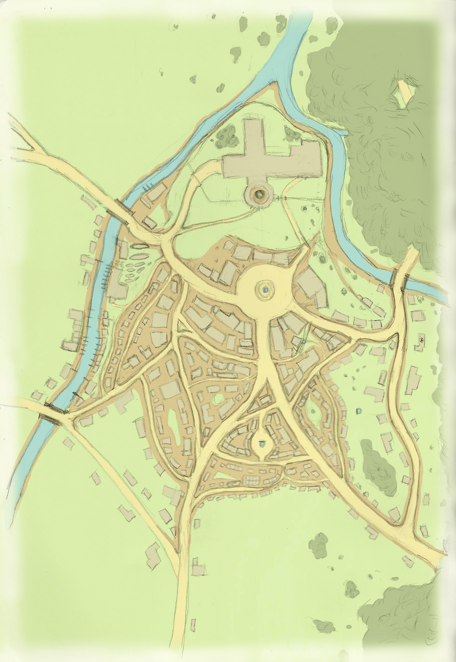
Town map of Ordlatha. The society of the town is very stratified. Rabbits make up the nobility and royal family who govern the region surrounding the town. Squirrels are the intellectual elite and wealthy landowners. Chipmunks are the skilled professionals, artisans, and merchants. Finally, mice make up the lower class as servants, farmers, fishermen, and maintenance workers, Catocala Hall is located at the northernmost tip of the town at the top of a slope that drops off sharply before it reaches the river. The Jordeka family home and workshop is located along the eastern edge of the town. The wealthier individuals live closer to the castle around the square, while poorer citizens live in neighborhoods toward the fringes of the town. The town is mostly home to merchants, artisans, servants, maintenance workers, and fishermen, while the farmers and wealthy landowners live on estates to the northeast and northwest of the town proper.
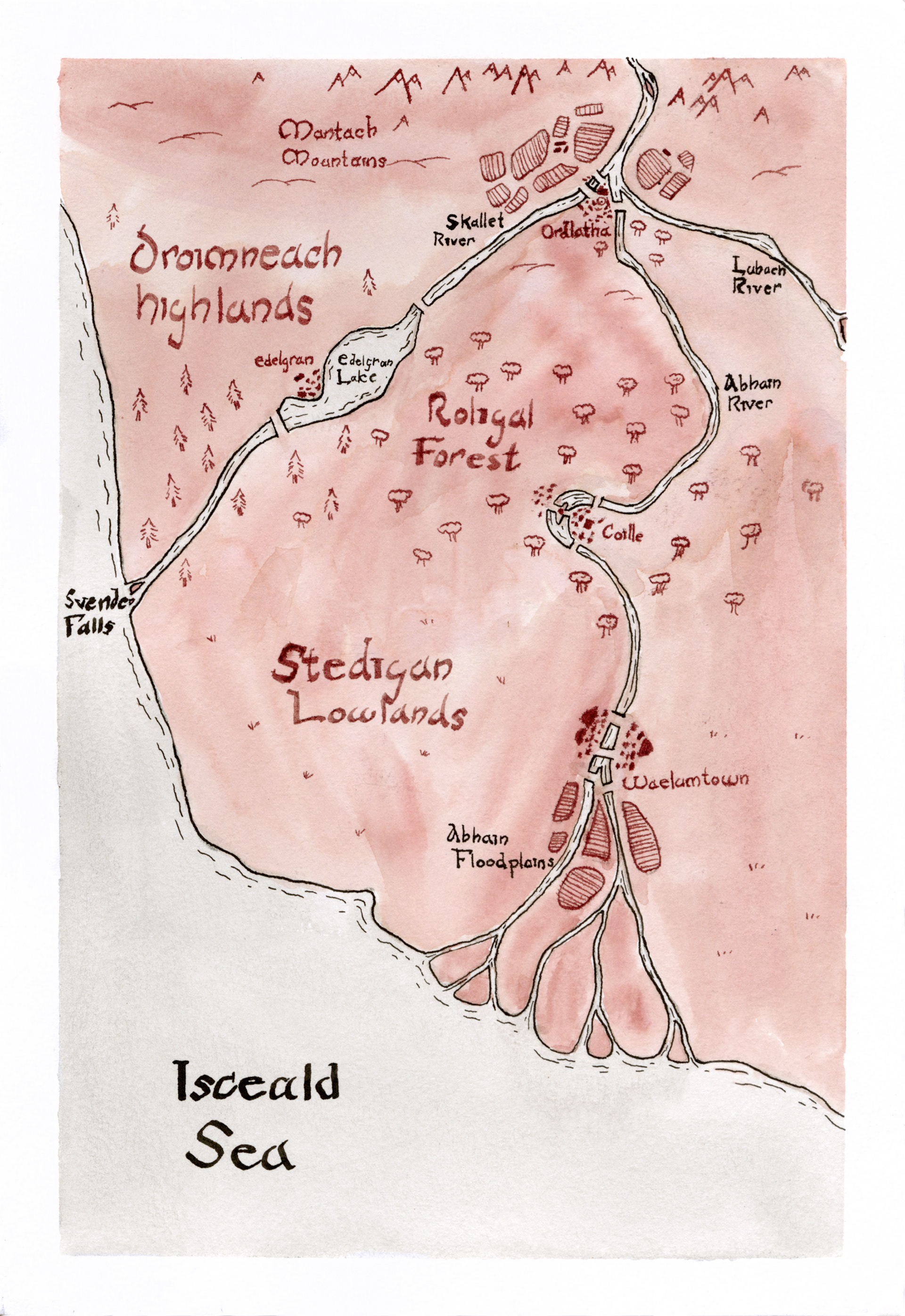
This map shows the landscape features and surrounding towns downriver from Ordlatha. When Iora and Kanina are swept downriver, they travel down the Abhain River and come to a stop on the Abain Floodplains. Their journey takes them through the farmlands on the river delta, then the Stedigan Lowlands immediately to the west of Waelumtown, then along the river through the town of Coille and the Roligal Forest, all the way back into the foothills of the Mantach Mountain range where Ordlatha is located.